PolarPASS Interactive Environments
Earth's polar environments have undergone rapid change during the 21st century and scientists have generated important new data and made groundbreaking insights. Despite growing interest to bring polar-focused material into the undergraduate classroom, curriculum development has lagged. Polar Space and Places, or PolarPASS, is connecting polar-focused material with innovative teaching methods to advance STEM undergraduate education and increase polar knowledge.
Context for Use
Using real data, diverse material types, and a range of activities, PolarPASS modules are designed to bring polar science and exploration to the classroom. PolarPASS modules link to Climate Literacy Principles and Polar Literacy Principles and are being tested in teaching models that include semester, quarter, and block teaching models.
PolarPASS is developed by a team of educators and scientists at Western Washington University, the University of Montana Western, and the National Snow and Ice Data Center and Cooperative Institute for Research in Environmental Sciences at the University of Colorado Boulder. During the initial development of PolarPASS materials, the team is testing the efficacy of different teaching activities in developing students' sense of place.
The PolarPASS team is excited to address your questions and hear about your experience using PolarPASS material. Please reach out to us at polarpass@colorado.edu.
Explore the full PolarPASS: Polar Places and Spaces in more depth on the PolarPASS Website

PolarPASS 360 IE Navigation Cover
Goals Header
Learning Goals
- Students use authentic scientific data to explore a Greenland glacier system. Students dive into questions about timescales, seasonal and year-to-year change, and interconnected Earth system element
- Students develop a sense of place via interactive environments, field images, maps, geospatial data, and videos
- Interactive and diverse activities support students in developing stronger inquiry-based learning skills and challenge students to ask and investigate questions about climate, ice, and the landscapes of our planet
- Students gain geospatial analysis skills through spatial and temporal exercises that utilize Greenland specific datasets in QGIS
Teaching Materials
Module 1 Unit 1 Part2a – Traveling to the Glacier Terminus
Explore the 'Traveling to the Glacier Terminus' Interactive Environment by following this link
Unit Objective: Overview of a glacier basin system
Driving Question: What is the geography and what are the system components of a Greenland glacier basin system?
IE Lesson Objective and Learning Goals:
- Develop a sense of place for the Kangerlussuaq glacier basin system.
- To visually explore the Watson River watershed.
Part 1: Traveling along the Watson River watershed to the Glacier Terminus
Module 1 Unit 1 Part 2b – Kangerlussuaq
Explore the 'Kangerlussuaq' Interactive Environment by following this link
Unit 1: Overview of a glacier basin system
Driving Question: What is the geography and what are the system components of a Greenland glacier basin system?
IE Lesson Objective and Learning Goals:
- Develop a sense of place for the Kangerlussuaq glacier basin system.
- To demonstrate that Kangerlussuaq and the Watson River watershed support a small community. To show this is a place where people live.
Town Description Text: Kangerlussuaq was initially established as a pre-WWII U.S. Air Force base. Because of this, the town is structured like a military base. However, it now serves as Greenland’s largest airport. As such, it hosts a transitory population, and a lot of the infrastructure is focused around supporting the airport and airport logistics. Therefore, many of the apartments and warehouses have interchangeable designations and purposes.
Part 2: Traveling from KISS to the Watson River Gauge
Module 1 Unit 2 Part 1 - On the Ice Sheet Surface
Explore the 'On the Ice Sheet Surface’ Interactive Environment by following this link
Unit Objective: Overview of a glacier basin system
Driving Question: What is the geography and what are the system components of a Greenland glacier basin system?
IE Lesson Objective and Learning Goals:
- Describe the processes that shape the components of the glacier surface.
- Recognize what the glacier surface system looks like in different seasons.
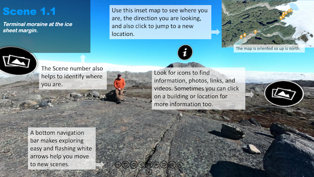
Explore locations along the ice sheet edge and on top of the ice sheet within the ablation zone, where winter snow disappears each summer and the ice sheet surface also melts.
Module 1 Unit 4 - Watson River Discharge
Explore the 'Watson River Discharge Early Season' Interactive Environment by following this link
Explore the 'Watson River Discharge Mid Season 1' Interactive Environment by following this link
Explore the 'Watson River Discharge Mid Season 2' Interactive Environment by following this link
Explore the 'Watson River Discharge Late Season' Interactive Environment by following this link
Explore the 'Nooksack Watershed Overview Part 1' Interactive Environment by following this link
Explore the 'Bagley Basin Nooksack Watershed Part 2' Interactive Environment by following this link
Explore the 'Nooksack Baker Glaciers Part 3' Interactive Environment by following this link
Unit Objective: To visually explore the Watson River at varying discharge levels over a melt season.
Driving Question: What are the temporal changes and physical properties of glacial meltwater for pro-glacial regions of a glacier basin system?
Learning Goals: How do seasonal changes in temperature influence the overall hydrology of a glacier basin system
Module 2 Unit 1 - Glacial Landforms
Explore the 'Glacial Landforms' Interactive Environment by following this link
Unit Objective: Learn about past ice margin retreat
Driving Question: How has the size and shape of the Greenland Ice Sheet changed over long time periods?
Learning Goals: Using 360 and still images, explore how the ice sheet margin change has varied over time and spatially.
Part 1: Exploring landscape features from the existing ice margin to past extents
-
Starting at the ice sheet and moving down the watershed


