QGreenland Beginner's Tutorial Series
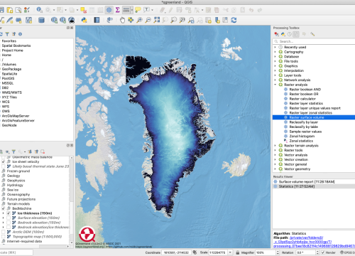
In this video series, you will become familiar with QGIS, learn how to download and browse the QGreenland Core data package, and explore the basic geospatial data analysis tools that make QGreenland a powerful tool for research, education, and local decision-making. The video tutorial series contains 7 short video sessions, for a total of one hour.
Context for Use
This video series educates learners on the QGreenland Core data package and shares tutorials on the basic geospatial data analysis tools that make QGreenland a powerful tool for research, education, and local decision- making. Learners will learn what data is included in the QGreenland Core Package, analyze Greenland data using geoprocessing tools, and find analysis tools and data relevant to their experiences or classes. The video series contains seven short video tutorials which in total span about one hour, and is best suited for beginner GIS or QGIS users.

QGreenland aims to serve the needs of researchers, educators, and Greenland residents, like those in the coastal community of Ilulissat.



Goals Header
Learning Goals and Outcomes
Students will...
- Learn how to use and interface with the QGreenland package in QGIS
- Explore what data is included in the QGreenland Core Package Analyze Greenland data using geoprocessing tools
- Find analysis tools and data relevant to you or your classes